


WATCH: It’s been a harsh winter for some parts of Canada and the U.S and it’s about to get worse. Jackson Proskow reports.
TORONTO – If you’re on the east coast, you’ve likely had your fill of snow. But you’re about to get a lot more.

Yet another low pressure system will make its way into the region Saturday evening. The system is expected to intensify Sunday as it sweeps across Nova Scotia and Prince Edward Island into Newfoundland and Labrador.
But first Newfoundland has to deal with Friday’s snowstorm that is expected to bring 20 cm of snow with winds gusting up to 110 km/h.

Get daily National news
READ MORE: Significant snowfall expected for Nova Scotia and P.E.I. on Friday
Environment Canada has already issued winter storm warnings for most of the island.
A special weather statement has been issued for New Brunswick, Nova Scotia, P.E.I. and Newfoundland ahead of Sunday’s system.
Meanwhile, Ontario is enduring a deep freeze where temperatures will plummet to -30 C in some parts of the province — without the windchill. Extreme cold warnings have been issued across much of the province.
- Osoyoos Band seeks return of sacred sites in discussions with B.C. government
- Record turnout expected for Penticton Peach Classic Triathlon, boosting local economy
- Mom and 1-month-old baby missing in northern B.C., not seen since July 9
- Hoekstra says Trump serious about tariff threat over wildfire smoke


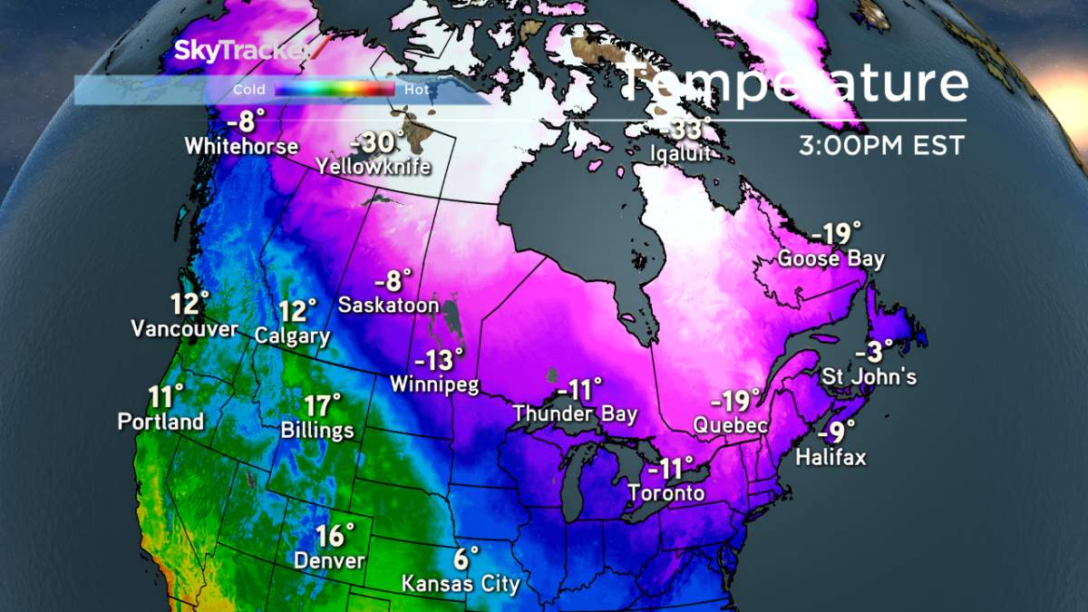
And then there’s Calgary where — on Friday afternoon — residents were enjoying a balmy temperatures of 15 C. You read that right: there’s no minus sign.
Canadian winters can be so cruel.


Comments
Want to discuss? Please read our Commenting Policy first.