


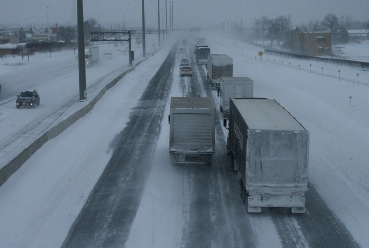
Environment Canada has issued a special weather statement, extending earlier snowfall warnings to Toronto, Mississauga – Brampton and York and Durham regions.

The weather agency is forecasting blustery conditions for many parts of the province starting on Sunday, and some regions could see 10 to 20 centimetres of snowfall by Monday night.
They are advising motorists to exercise caution and prepare for poor visibility and icy roads.
Earlier Environment Canada issued special weather statements for the following regions:
- Kingston – Prince Edward
- Apsley – Woodview – Northern Peterborough County
- Stirling – Tweed – South Frontenac
- Bancroft – Bon Echo Park
- Haliburton
- Barrie
- Collingwood
- Hillsdale
- Osoyoos Band seeks return of sacred sites in discussions with B.C. government
- Record turnout expected for Penticton Peach Classic Triathlon, boosting local economy
- Mom and 1-month-old baby missing in northern B.C., not seen since July 9
- Hoekstra says Trump serious about tariff threat over wildfire smoke


Snow squall watches were also issued for the following communities:

Get breaking National news
- Stratford
- Mitchell
- Southern Perth County
- Listowel
- Milverton
- Northern Perth County
- Orangeville
- Grand Valley
- Southern Dufferin County
- Bruce Peninsula
- Sauble Beach
- Tobermory
- Hanover
- Dundalk
- Southern Grey County
The heaviest snowfall is expected tonight into the overnight hours combined with gusting northwest winds between 50 to 70 km/h.
Strong winds have resulted in hydro outages for some areas.
Environment Canada said the snowfall should taper off by Tuesday.


Comments
Want to discuss? Please read our Commenting Policy first.