


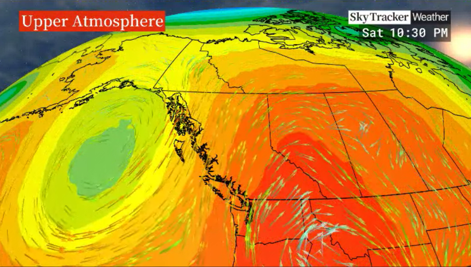
After some slight moderation in daytime highs over the weekend, to the mid-30s C, a gradual warm-up is on the way for the work week ahead.

An upper ridge of high pressure re-establishes itself over the area, bringing back sunshine with a high around 37 C Monday afternoon.
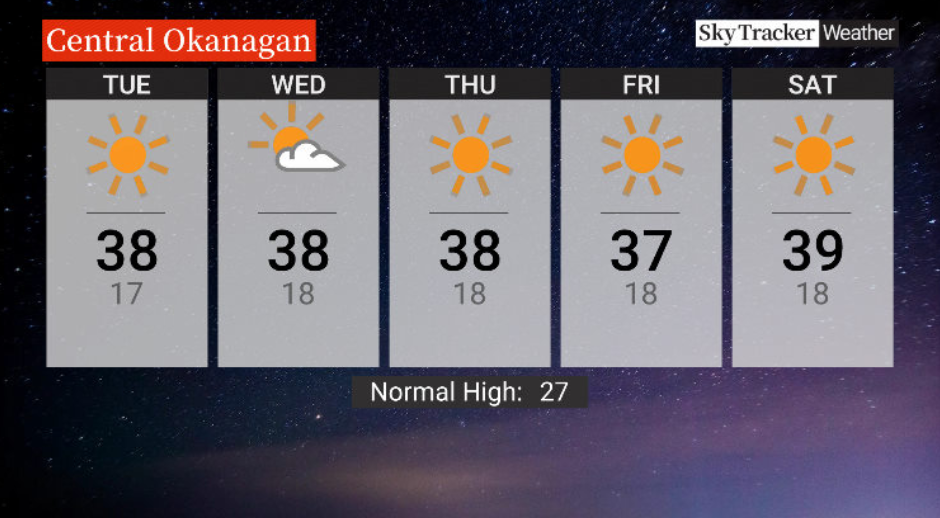
Mostly sunny skies are expected through the middle of the week with highs staying in the upper-30s and lows just a few degrees into the teens at night, not giving much relief.

Get daily National news
The week will end on Friday with highs around 37 C as the sunshine sticks around.
No relief is expected for the weekend ahead, with highs in the upper 30s or low 40s C as the sunshine continues and the ridge further strengthens.
- IBC estimates $230M in insured damage claimed from Edmonton storms
- Calgary area ‘very uniquely situated’ for study of hailstorms, says researcher
- Saskatchewan boosts disaster aid in response to storm-packed spring and summer
- Flooding damage closes Telus World of Science for months, 68% of staff laid off


For weather on the go download the Global News SkyTracker Weather App for iPhone, iPad or Android.


Comments
Want to discuss? Please read our Commenting Policy first.