


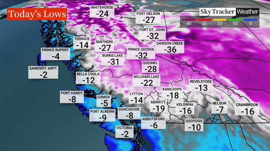
B.C. remains in the grips of an Arctic ridge of high pressure as temperatures plummeted around the province.

On Wednesday morning, Global BC meteorologist Mark Madryga said Vancouver Airport unofficially recorded -8.8 C, within just 1/10 of a degree of the all-time record for Feb. 5.
Although daytime and nighttime readings across most of B.C. will rise slightly heading into the upcoming weekend, they will still be well below average for early February, and will likely drop several degrees again early next week, Madryga added.
As of 6 a.m. on Wednesday, the wind chill values read as below. The wind chill is a combination of wind and air temperatures.
- IBC estimates $230M in insured damage claimed from Edmonton storms
- Calgary area ‘very uniquely situated’ for study of hailstorms, says researcher
- Saskatchewan boosts disaster aid in response to storm-packed spring and summer
- Flooding damage closes Telus World of Science for months, 68% of staff laid off


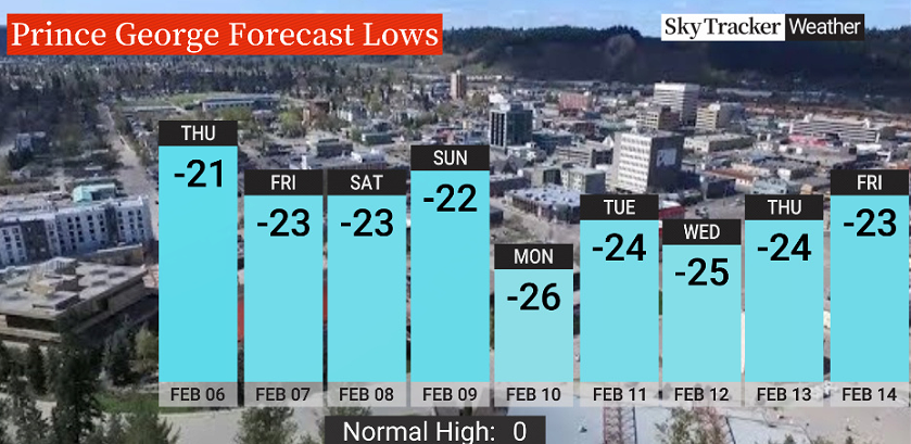
Here is a look at the forecast lows for Prince George, Kelowna and Metro Vancouver heading into next week.


Comments
Want to discuss? Please read our Commenting Policy first.