


It’s not a pretty picture.

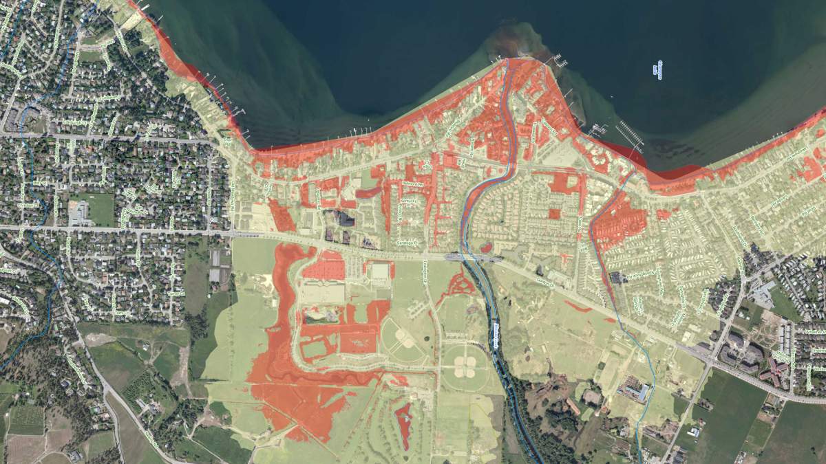
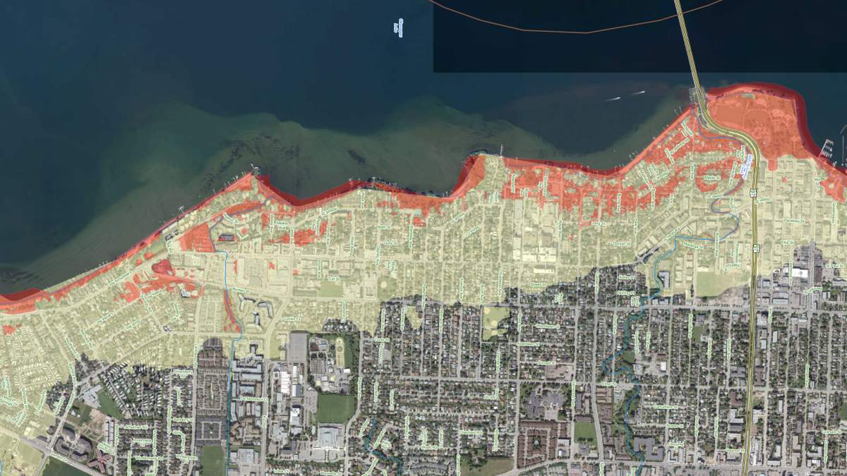
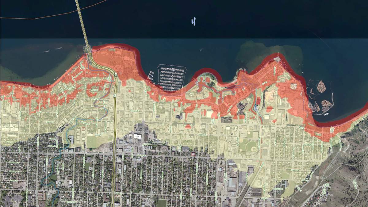
Maps have been prepared for the Central Okanagan Emergency Operations Centre showing flood areas of Kelowna if Okanagan Lake rises to the projected level of 343.5 metres.
They show affected areas several blocks from the waterfront.
However, a centre spokesperson says much of the potential flooding would happen only if no flood measures were taken.
“We do however have many forms of flooding protection measures in place including pumps, gabion barriers, sandbags and water dams,” says Laura Wilson in an email to Global Okanagan News.

Get daily National news
Get daily Canada news delivered to your inbox so you'll never miss the day's top stories.
By providing your email address, you have read and agree to Global News' Terms and Conditions and Privacy Policy.
Other maps denote the high water table and possible impact areas from rising ground water.
Residents in low-lying areas should continue to monitor basements and crawl spaces.





Comments
Want to discuss? Please read our Commenting Policy first.