


After a cool start to the week that saw a foot of snow fall at Silver Star, much milder days are on the way.

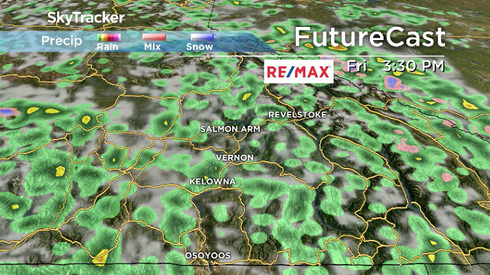
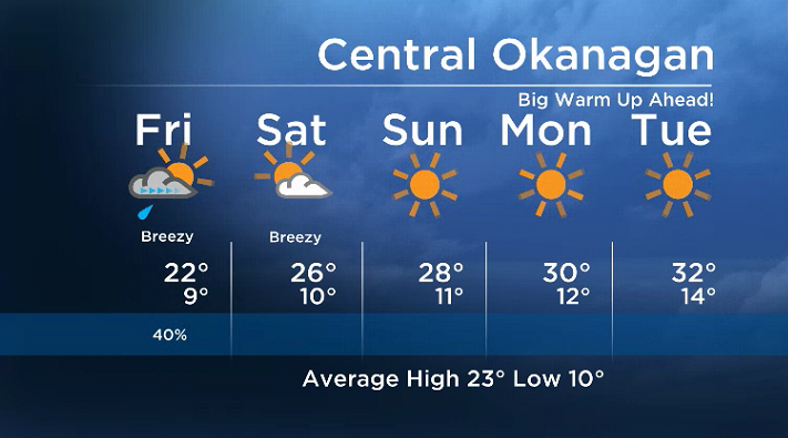
One more day of cool, cloudy and unsettled conditions will stick around to finish off the week the way it started on Friday, with temperatures seeking to make it into the low 20s.
READ MORE: Powder anyone? A foot of snow falls at Silver Star
A good chance of showers and thunderstorms will continue into the afternoon and early evening before the low-pressure system and upper trough that brought in the cooler week finally moves out.
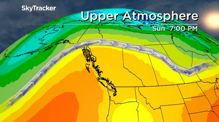
Mid-20 degree heat returns to kickoff the weekend on Saturday under a mix of sun and cloud before a building upper ridge really starts to take hold.
As it does, temperatures will spring up even further, into the upper 20s with nothing but blue skies and sunshine for Father’s Day.
- IBC estimates $230M in insured damage claimed from Edmonton storms
- Calgary area ‘very uniquely situated’ for study of hailstorms, says researcher
- Saskatchewan boosts disaster aid in response to storm-packed spring and summer
- Flooding damage closes Telus World of Science for months, 68% of staff laid off



Get breaking National news
But it gets even better – next week will be sizzling as the heart of the heat rolls in with daytime highs soaring into the low-to-mid 30s by mid-week under sunny skies.
For the latest weather alerts download the Global News SkyTracker Weather App for iPhone, iPad or Android.


Comments
Want to discuss? Please read our Commenting Policy first.