


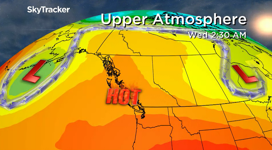
A big blast of heat and dry weather is on the way across the Okanagan this week.

The culprit is a massive blocking pattern in the upper atmosphere known as an Omega block, which is a heat and sunshine filled ridge of high pressure, shaped like the Greek letter Omega, which likes to park itself in place for long periods of time.
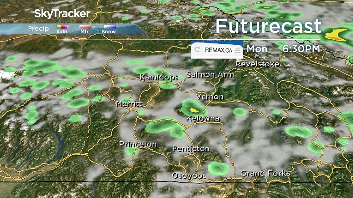
In the short-term though, there is a chance of some spotty showers and the risk of a thunderstorm with a bit of lightning into Monday evening with wind gusts up to 50 km/h possible.
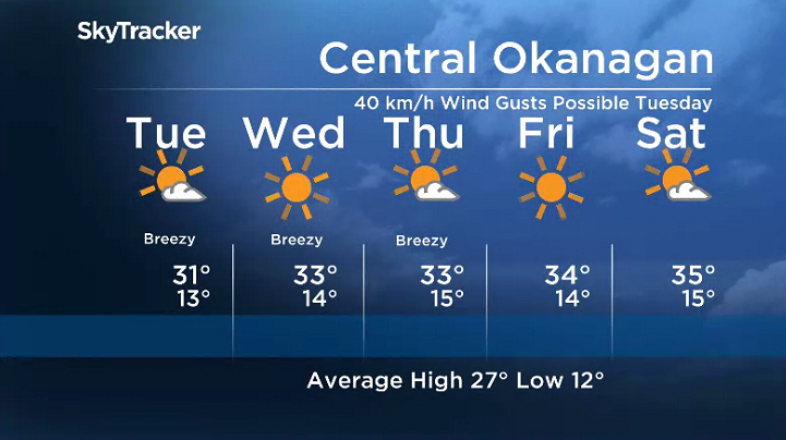
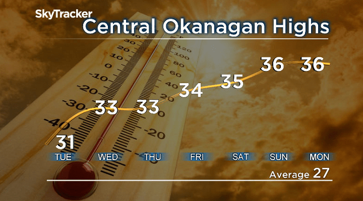
Mostly sunny skies will stick around on Tuesday with breezy northerly winds kicking in during the afternoon with gusts of 40 km/h at times we temperatures heat up into the low 30s.

Get daily National news
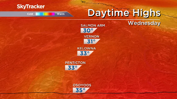
The real effects of the Omega Block moving in will start to be felt on Wednesday when daytime highs climb into the 33 degree range under pure blue skies and sunshine.
- IBC estimates $230M in insured damage claimed from Edmonton storms
- Calgary area ‘very uniquely situated’ for study of hailstorms, says researcher
- Saskatchewan boosts disaster aid in response to storm-packed spring and summer
- Flooding damage closes Telus World of Science for months, 68% of staff laid off


Breezy afternoon winds will linger across the region into Thursday with blue skies and sunshine sticking around right into the weekend as daytime highs climb even further into the mid-30s.
With not a drop of rain in sight for the extended forecast, expect the fire danger rating to remain at very high to extreme in most cases, which means fire can spread very quickly in the extremely dry conditions.
For weather on the go download the Global News SkyTracker Weather App for iPhone, iPad or Android.


Comments
Want to discuss? Please read our Commenting Policy first.