



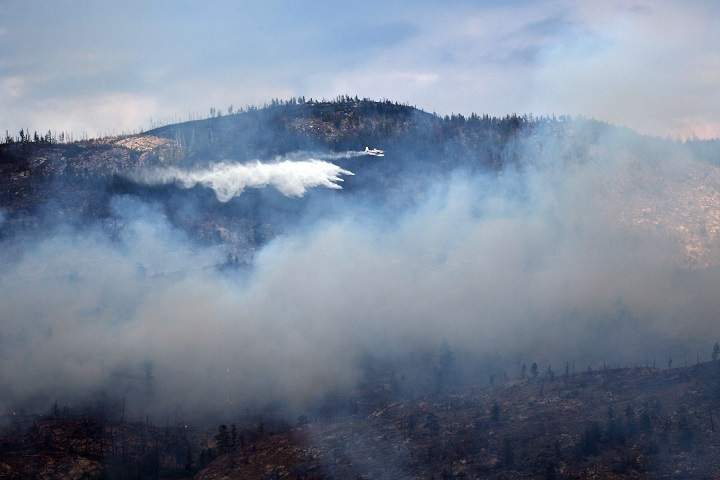
It was a good news day for firefighters in the Okanagan in that there was little news to report on Tuesday.

Of the major fires currently burning in the Valley, none had grown in size from this morning. Below is a quick breakdown of the major fires.
In related news, the B.C. Wildfire Service says a campfire ban throughout the Kamloops Fire Centre, which includes the Okanagan, will start on Thursday.
The fire danger ratings in the Kamloops Fire Centre are now generally moderate or high, but these ratings will likely increase this week. Hot and dry conditions are expected to continue.

Get breaking National news
Prohibited activities will also include the use of:
- fireworks (including firecrackers)
- sky lanterns
- burn barrels or burn cages of any size or description
- binary exploding targets (pre-packaged or homemade explosives, such as Tannerite, Thundershot, Gryphon, Firebird SS65, Sure Shot, or similar products)
- tiki torches and similar kinds of torches
- chimineas, outdoor stoves and other portable campfire apparatuses that are not CSA-approved or ULC-approved
These prohibitions apply to all public and private land unless specified otherwise (for example, in a local government bylaw). Please check with local government authorities for any other restrictions before lighting any fire.
These prohibitions do not apply to CSA-rated or ULC-rated cooking stoves that use gas, propane or briquettes, or to a portable campfire apparatus that uses briquettes, liquid or gaseous fuel, so long as the height of the flame is less than 15 centimetres.
Prohibitions on Category 2 and Category 3 open burning remain in effect throughout the Kamloops Fire Centre’s jurisdiction. The campfire prohibition will remain in effect until October 15, or until the public is otherwise notified.
Anyone found in contravention of an open fire prohibition may be issued a ticket for $1,150, required to pay an administrative penalty of $10,000 or, if convicted in court, fined up to $100,000 and/or sentenced to one year in jail. If the contravention causes or contributes to a wildfire, the person responsible may be ordered to pay all firefighting and associated costs.
Mount Eneas
- Location: Approximately 4 kilometres south of Peachland
- Size: 1,793 hectares
- Status: Active. Classified as out of control and exhibiting rank 1 and rank 2 fire behaviour.
- Evacuation alerts: CORD evacuation alerts remain in effect. RDOS evacuation orders were downgraded to Alerts.
- Cause: Lightning
- Resources: 74 firefighters
Goode’s Creek
- Location: Okanagan Mountain Park near Kelowna
- Size: 577 hectares.
- Status: Active. Skimmers are actively working the southeast flank.
- Cause: Lightning.
- Resources: 33 firefighters
Law Creek
- Location: Six kilometres southwest of West Kelowna
- Size: 16 hectares
- Status: Active.
- Cause: Lightning.
- Resources: • 28 firefighters. Crews will continue to mop up 100 feet off of each side of hose lays that are going through the interior of the fire. Crews will continue to burn out additional bays or green fingers as necessary.
Mount Conkle
- Location: Near Shingle Creek Road and roughly 8 kilometres southwest of Summerland
- Size: 118 hectares
- Status: Active. This wildfire is classified as being held as we don’t anticipate further growth due to weather and suppression tactics.
- Interface: This is not an interface fire.
- Cause: Lightning
- Resources: • 32 firefighters. Crews will continue to extend hose lays and mop up perimeter to 100 feet. This fire has lots of fingers that crews are dealing with and it can be spotty.
Glenfir Road
- Location: 10 kilometres northwest of Naramata
- Size: 32 hectares
- Status: Active.
- Interface: This is not an interface fire. Structures are not threatened at this time. This wildfire is producing smoke as a result of fuel burning in crevices and small steep canyons.




Comments
Want to discuss? Please read our Commenting Policy first.