



A Pacific frontal system is rapidly advancing from the south and towards the B.C. coast.

Rain will be widespread on B.C.’s south coast Monday afternoon and evening, while significant wind will develop overnight through Tuesday morning in many south coastal regions.
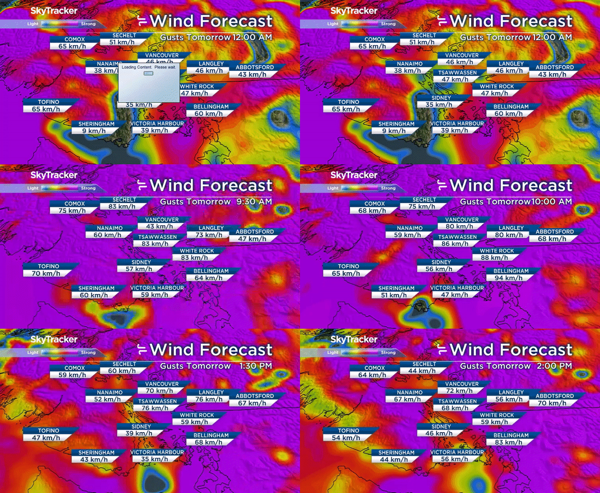
This computer forecast chart shows a sample of probable wind speeds starting at midnight, then 10 a.m. Tuesday followed by 2 p.m. Tuesday.
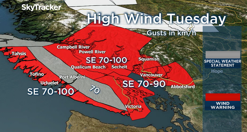
Environment Canada has issued a wind warning for Metro Vancouver, the western Fraser Valley, Howe Sound, Greater Victoria, and the Southern Gulf Islands.

Get daily National news
Strong winds are expected Tuesday morning and southerly gusts could top 90 km/h over the Strait of Georgia and Haro Strait.
With significant wind in the forecast, the public should be prepared for the possibility of power outages and ferry disruptions.
Environment Canada warns high winds may toss loose objects or cause tree branches to break.
Wind will gradually ease in most areas later on Tuesday.
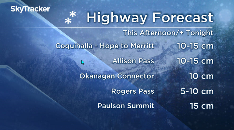
Meanwhile, snow will spread northwards into the southern highway passes later Monday through the evening. Much milder air should turn the snow to rain in some places Monday night, with a risk of freezing rain.
- Calgary area ‘very uniquely situated’ for study of hailstorms, says researcher
- Saskatchewan boosts disaster aid in response to storm-packed spring and summer
- Flooding damage closes Telus World of Science for months, 68% of staff laid off
- Wildfire smoke transforms skies as air quality plummets across Canada


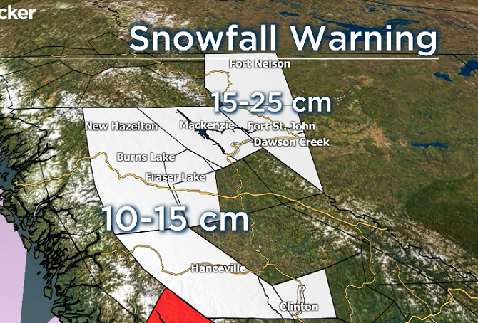
Snow will continue northwards through the Cariboo and into central and northern B.C. Monday night. Snowfall warnings are in effect.
— With files from Gord Macdonald


Comments
Want to discuss? Please read our Commenting Policy first.