




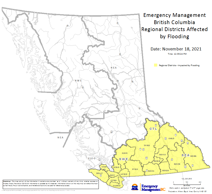
The B.C. government has provided a flooding map to show what areas of the province have been affected by the atmospheric river in mid-November.

A total of 17 regional districts were affected by floods, mudslides and landslides when about a month’s worth of rain fell on that part of the province in about two days, Emergency Management BC said.
That includes southern Vancouver Island, the South Coast, parts of the Interior and the Kootenay Region.
Thousands of residents have been affected by the flooding. One woman is confirmed to have died and four others remain missing.

- IBC estimates $230M in insured damage claimed from Edmonton storms
- Calgary area ‘very uniquely situated’ for study of hailstorms, says researcher
- Saskatchewan boosts disaster aid in response to storm-packed spring and summer
- Flooding damage closes Telus World of Science for months, 68% of staff laid off


The financial assistance is for those affected by the flooding and landslides from Nov. 14 to 16, 2021.

Get daily National news
An application can be accessed online on the government website.
The province declared a provincial state of emergency on Wednesday in order to provide additional resources to the continued effort towards rebuilding.
This assistance includes all Indigenous communities, electoral areas and municipalities within the geographic boundaries of these areas.


Comments
Want to discuss? Please read our Commenting Policy first.