




Weather alerts are in effect for much of southern Ontario ahead of a winter storm that’s expected to move in Thursday.

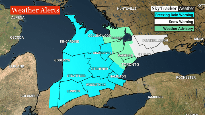
Environment Canada has issued a freezing rain warning for areas from Lake Huron, down to London and east to Hamilton. The warning is also in effect for western parts of the Greater Toronto Area.
From Toronto, north up to Barrie, a weather advisory is in effect, warning of a messy mix of precipitation.
Further east into Durham Region and up to Peterborough, a snowfall warning is in effect.
“Rain or snow begins by mid-morning in the GTA and quickly transitions to all snow,” Global News meteorologist Anthony Farnell said.
“The heaviest snow will be done by 4 p.m. but expect a very slow afternoon commute.”
Winds could gust up to 70 km/h in the morning and 50 km/h in the afternoon, Farnell said.

Get daily National news
“Temperatures will remain just above freezing on Thursday and Friday so the snow will be very wet and likely melt and compact shortly after falling,” he said.
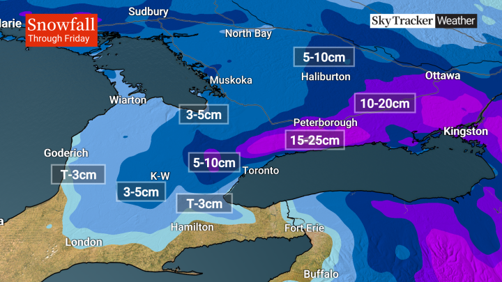
Areas near the lake can expect five to 10 cm of snow, while areas north of Highway 401 could see 10 to 20 cm.
- IBC estimates $230M in insured damage claimed from Edmonton storms
- Calgary area ‘very uniquely situated’ for study of hailstorms, says researcher
- Saskatchewan boosts disaster aid in response to storm-packed spring and summer
- Flooding damage closes Telus World of Science for months, 68% of staff laid off


And for Durham Region towards Kingston, more than 20 cm may accumulate by the time everything wraps up Friday afternoon.


Comments
Want to discuss? Please read our Commenting Policy first.