


The winter weather isn’t quite done with B.C.’s Lower Mainland yet.

Environment Canada has issued fresh snowfall warnings for Metro Vancouver’s North Shore and northeast, including Coquitlam and Maple Ridge, along with the Coquihalla Highway between Hope and Merritt and the Fraser Canyon.
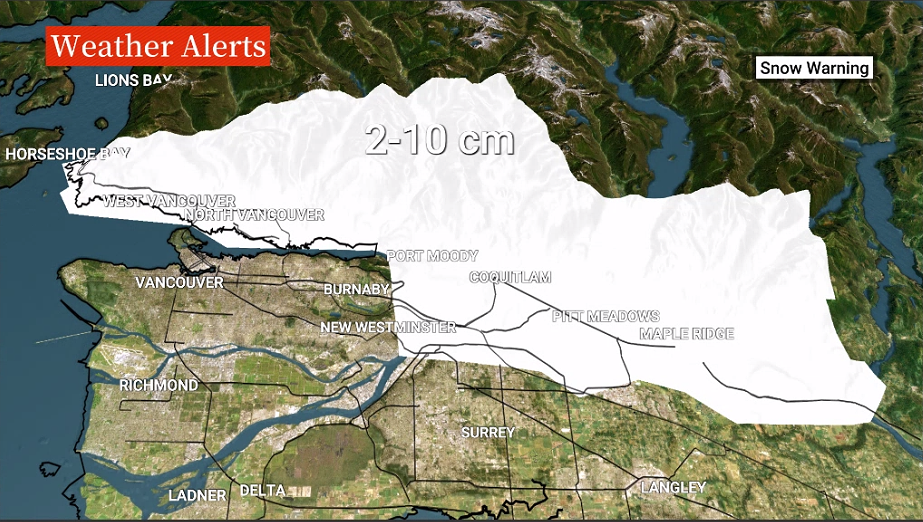
“The precipitation will be highly variable across the Lower Mainland today and tonight,” Global BC senior meteorologist Kristi Gordon said.
“Temperatures Friday afternoon will range between 3 C and 6 C. Despite being above freezing, we still have a chance of seeing snowfall, especially for areas above 150 meters.”
Gordon said as temperatures dropped into the evening, the chance of snow sticking on the ground would increase.

Get daily National news
Snowfall of between five and 10 centimetres is forecast at higher elevations, starting Friday afternoon and into early Saturday morning.

- IBC estimates $230M in insured damage claimed from Edmonton storms
- Calgary area ‘very uniquely situated’ for study of hailstorms, says researcher
- Saskatchewan boosts disaster aid in response to storm-packed spring and summer
- Flooding damage closes Telus World of Science for months, 68% of staff laid off


“A Pacific frontal system approaching the South Coast will produce snow over higher terrain. With cool temperatures already in place, snow levels could drop to 150 to 300 metres late this afternoon, depending on precipitation intensity,” Environment Canada said.
“Snow will be heaviest late this afternoon and evening before tapering off to periods of light snow after midnight. Snow will cease Saturday morning.”
Drivers are being reminded to slow down and to drive for the conditions, and that visibility may be suddenly reduced by heavy snow.



Comments
Want to discuss? Please read our Commenting Policy first.